About a year and a half ago, I randomly watched a video on social media of a landscape so unreal that I thought it was fake. While searching, I discovered an unknown spot on the map, somewhere in the middle of southwestern Kazakhstan. Its name was Mangystau, like the rest of the region, but also the small town next to Aktau, the capital of that region and an important port on the Caspian Sea. The area with these colorful, strange geological formations that belongs to the Ustyurt National Park and that once formed the bottom of the prehistoric Tethys Ocean is also referred to as Mangystau.
The time this place came to my attention and immediately triggered my interest, I was about to visit Afghanistan, so I saved Mangystau on my future travel list. One year later, in November 2024, I decided to return to Central Asia, in order to complete my tour of the western Uzbekistan and Karakalpakstan, to cross the border to southwestern Kazakhstan and Mangystau, and continue towards the southern part of the country up to Shimkent. To be able to organize my visit to the region, I got in touch with the local agency “Red Maya Travel”. Since I was about to visit the area during the low season, I couldn’t participate in a group tour, so I decided to book a 2-day private tour by 4×4 jeep to the most impressive places of interest in Mangystau, as there are no paved roads for a conventional vehicle.
Tour program:
Day 1:
We departed Aktau early in the morning, and after hours of driving across the endless flat steppes of Kazakhstan, our first stop was the Necropolis and the underground mosque of Shopan Ata to visit, but also to enjoy our lunch, in the guesthouse of the main mosque outside the Necropolis.
In order to catch the sunset, we arrived at the most impressive sight in the area, the surreal Bozjyra plateau.
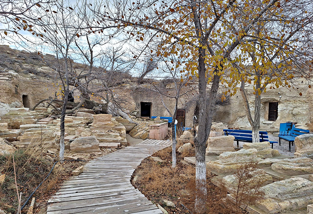
We spent the night in a guest room at the Beket Ata Mosque, another underground mosque that we visited the next day early in the morning, before starting our tour to the rest of the area.
Day 2:
After visiting Beket Ata, we departed to the Bozjyra panorama, with the endless views to the magnificent rock formations and the desert landscape, and continued towards Bokty mountain, which is featured on the 1000 tenge banknote of Kazakhstan.
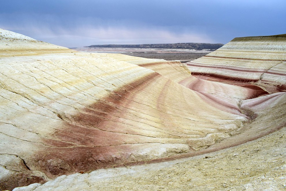
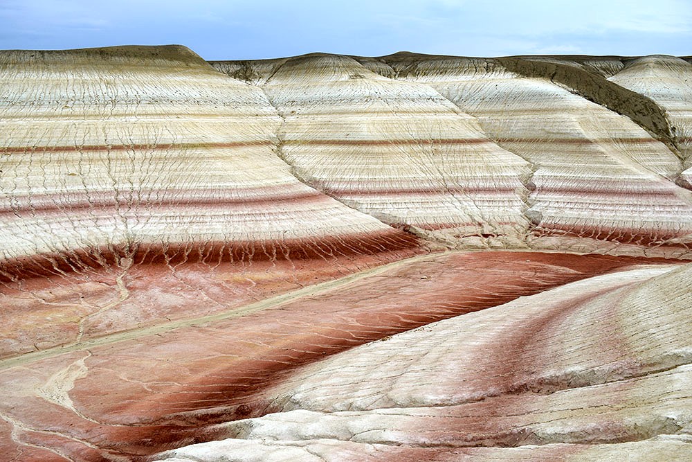
Last stop was the Tiramisu Hills, with their dazzling reddish colors that alternate at different levels.
On the way back to Aktau, we visited a camel farm, while our final stop was the area’s golden sand dunes.
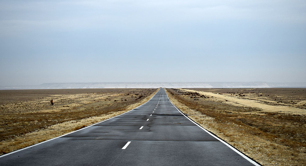
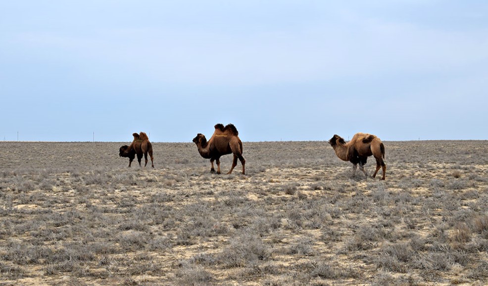
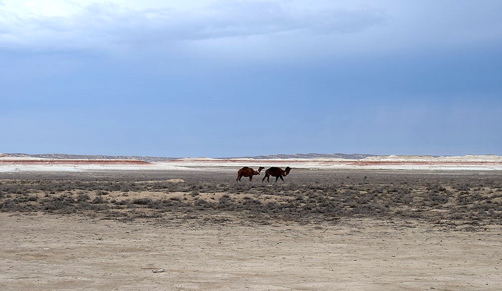
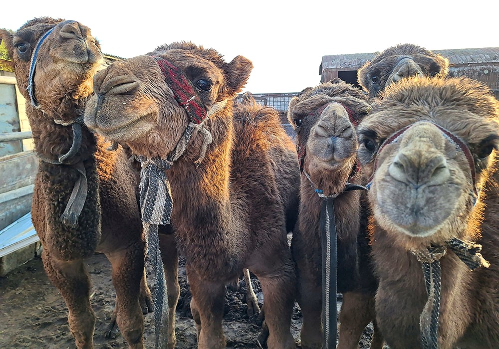
The route from Aktau to our first stop at the Necropolis was monotonous, crossing vast expanses of flat steppes. The only interest was a few scattered one or two humped camels, the well-known Bactrians of Central Asia, which were roaming free for some time, until they were gathered by their owners back to the farms.
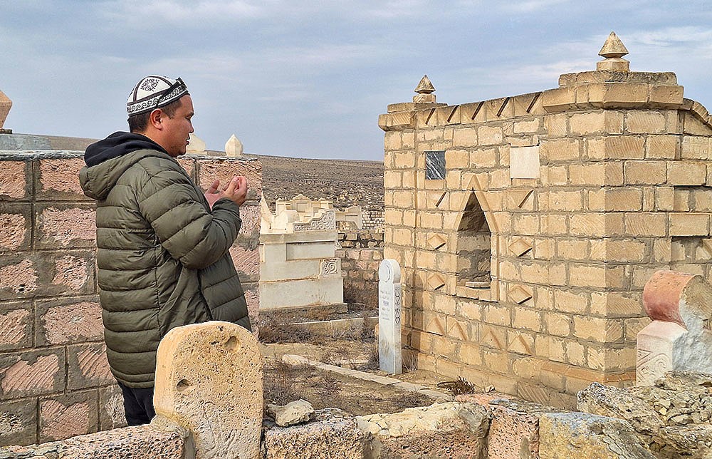
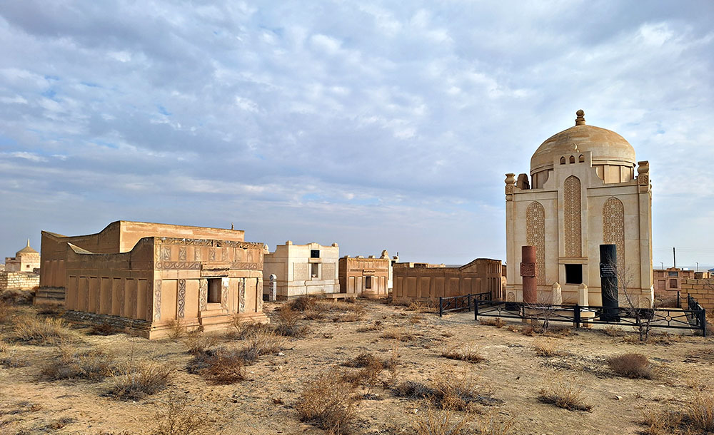
The Shopan – Ata Necropolis and underground mosque is one of the sacred places to the pilgrims of the Mangystau area, and it is considered an exemplary representation of Sufi architecture. The cemetery is home to various monuments, such as ancient fences, tombstones and boulders, typical to the medieval Turkmen and Kazakh culture. Carved into the rock, the mosque consists of 12 small rooms connected to each other, each serving a different purpose.
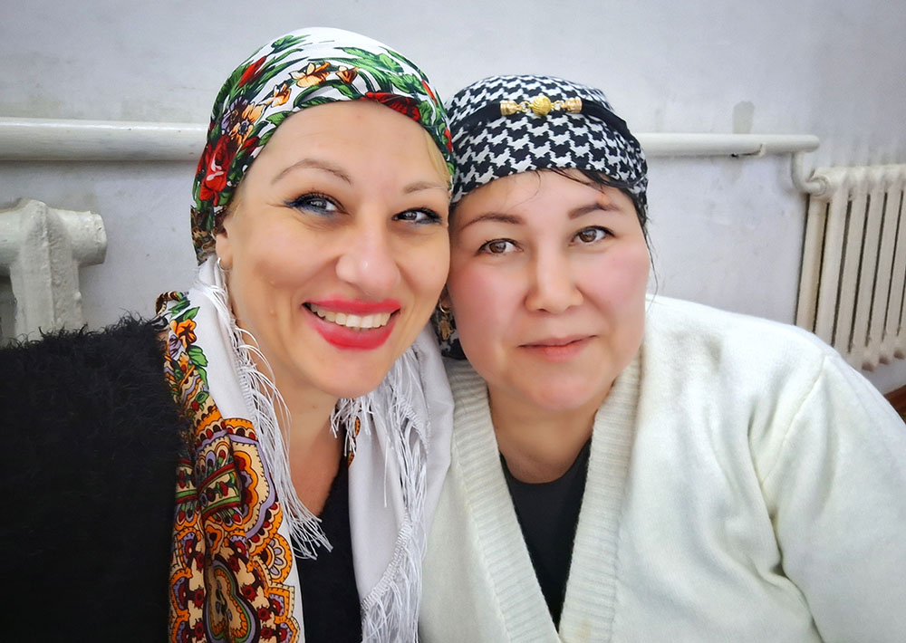
We – me and my driver – first had lunch at the guesthouse of the main mosque outside the Necropolis, and then we toured around the tombs and the underground mosque, which turned to be very unique and extremely interesting.
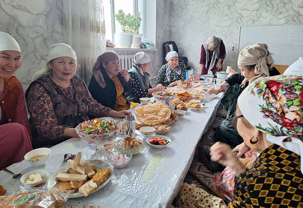
The guesthouse, where visitors of the entire area can be hosted or just have a short stop to relax, was packed with local pilgrims and a small group of tourists, while the low dining tables were full of different kinds of food, bread, candies and sweets, offered by the visitors. We had already bought our own meal from a local restaurant, and we enjoyed the traditional tea with milk, which is never missing on the Kazakh table.
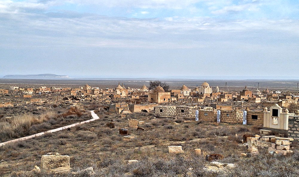
Shopan Ata Necropolis
the underground mosque of Shopan Ata
the entrance and main hall of the mosque
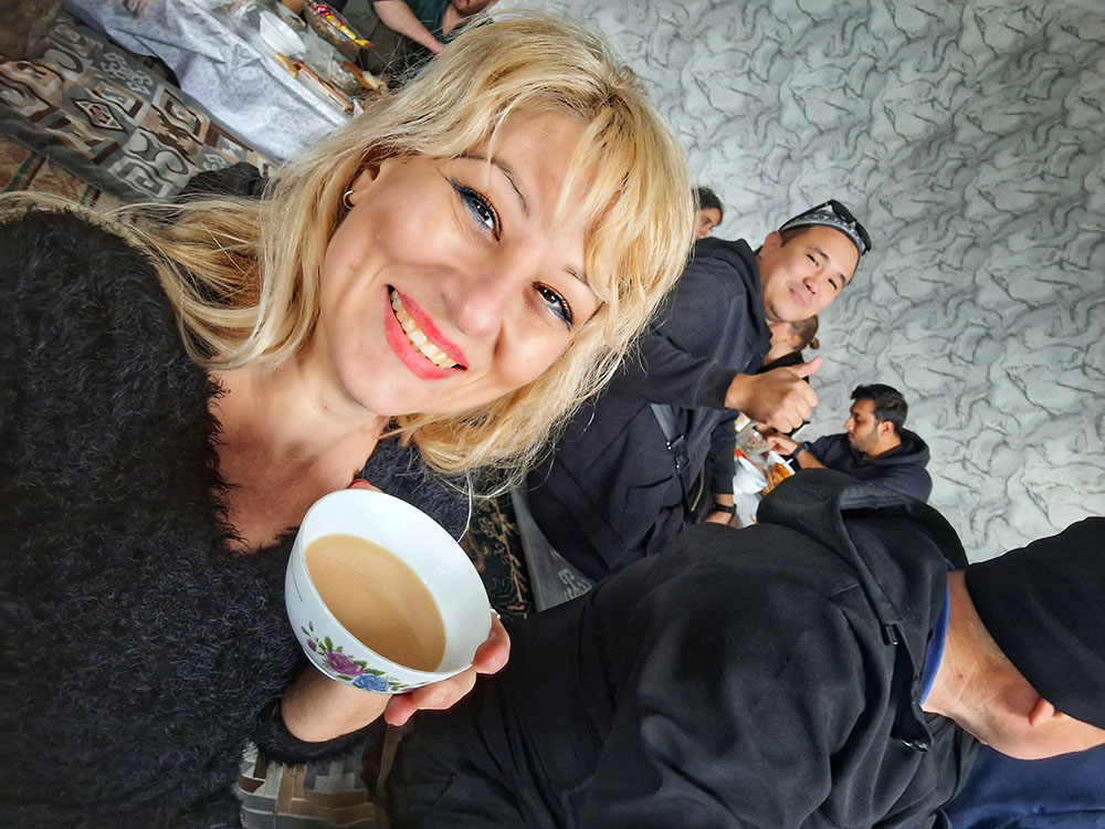
Enjoying the traditional Kazakh tea in the guesthouse
on our way to Bozjyra
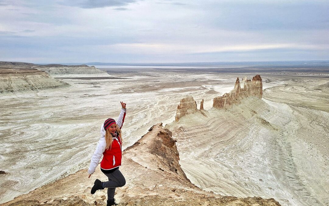
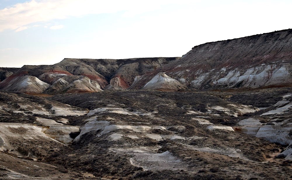
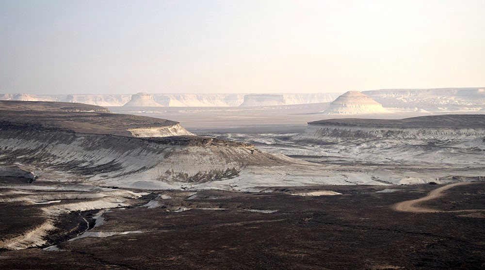
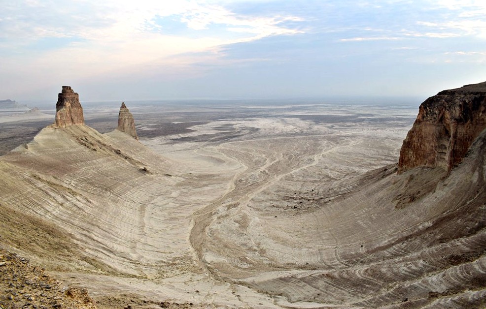
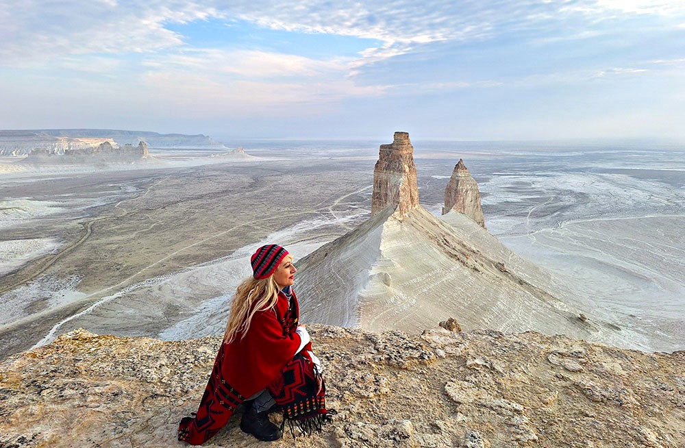
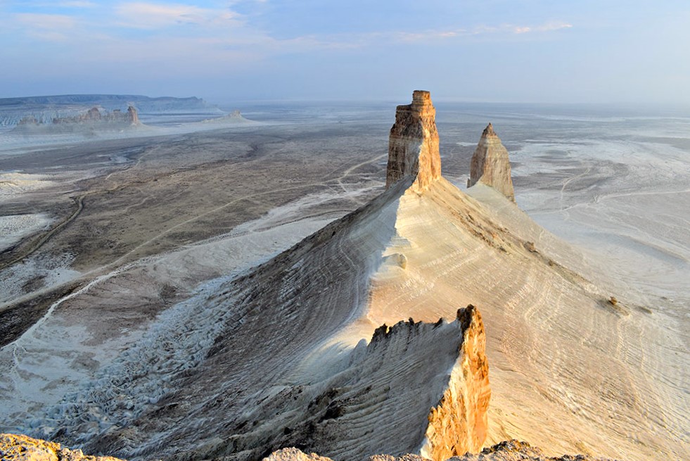
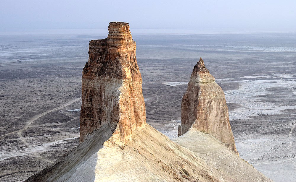
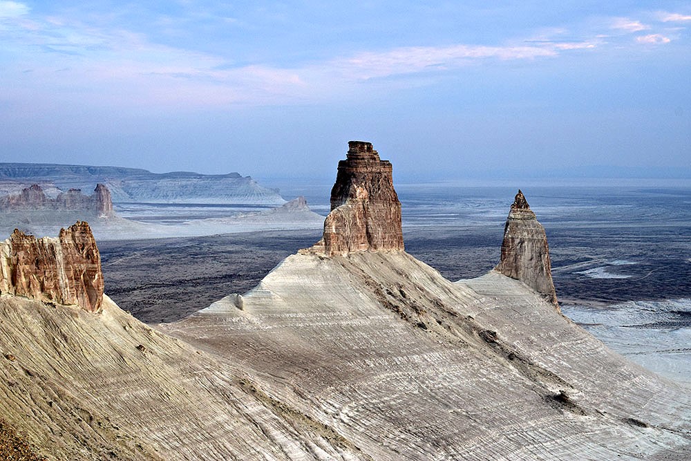
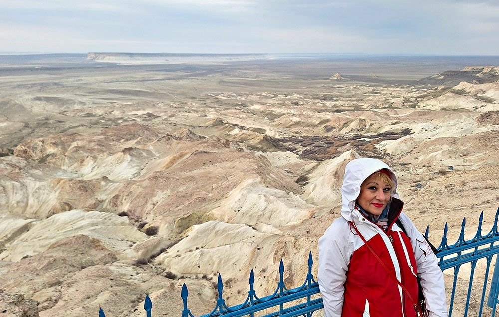
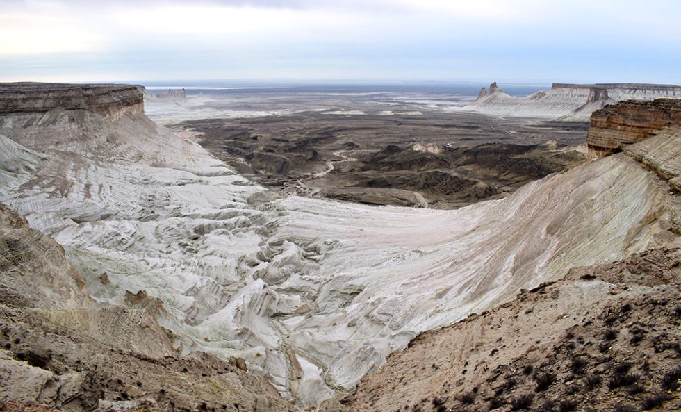
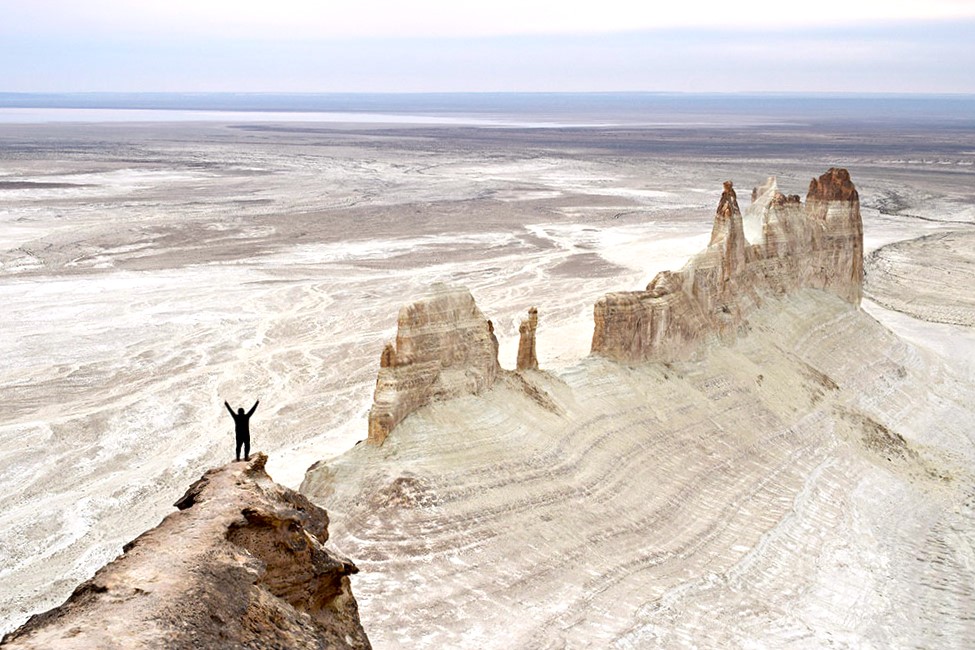
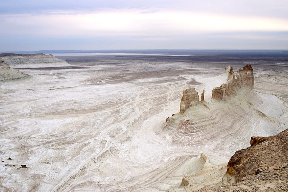
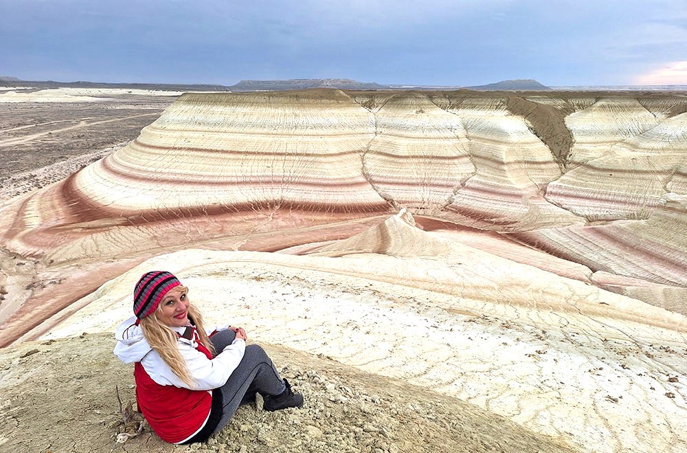
Next destination just before sunset was Bozjyra, the stunning natural wonder with a unique landscape of eroded rock formations and beautiful canyons.
“Bozjyra is a magnificent creation of weathering and erosion, part of the Ustyurt Plateau and includes vast clay deserts, limestone mountains, and sharp cliffs over 200 meters high. In the Mesozoic era, this area was covered by the Tethys Ocean, where ocean waves and then the sun and wind when all the water disappeared, shaped the landscape into what can be seen today, the arid, light gray landscape that made it look like a piece of the Moon on Earth. In some places, many fossilized shells and teeth of prehistoric sharks can be found.”
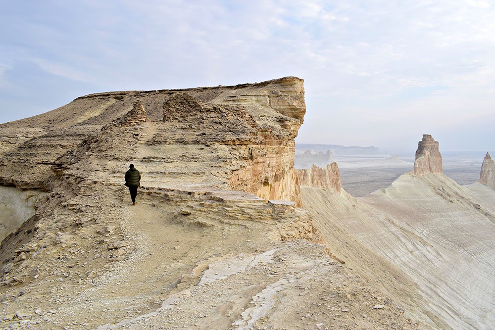
After driving for about an hour and a half on the rocky plateau, we parked our car under a huge rock, which we would have to climb on foot for 15 to 20 min. While from that side you can’t really understand what you are going to face, the moment you reach the top, what you see literally takes your breath away!
A vast, endless, white rocky desert stretches as far as the eye can see!
Only a few scattered pointed rocks, sprouting randomly from the bowels of the earth, interrupt this incredible vastness!!
Where am I standing now, am I still on earth,
or was I transported in some inexplicable way to the planet Mars?
We kept on walking a little further down, to the point with the panoramic view, right above the impressive rocks of the photo. There are no words to describe the feeling of that moment! Only awe and respect towards the most talented artist, the nature itself!
Unfortunately, the sky was not very clear, but at least we managed to take a few photos and leave before dark. We ended up at the Beket Ata Mosque, to enjoy our dinner once more together with the local pilgrims and sleep in the guesthouse.
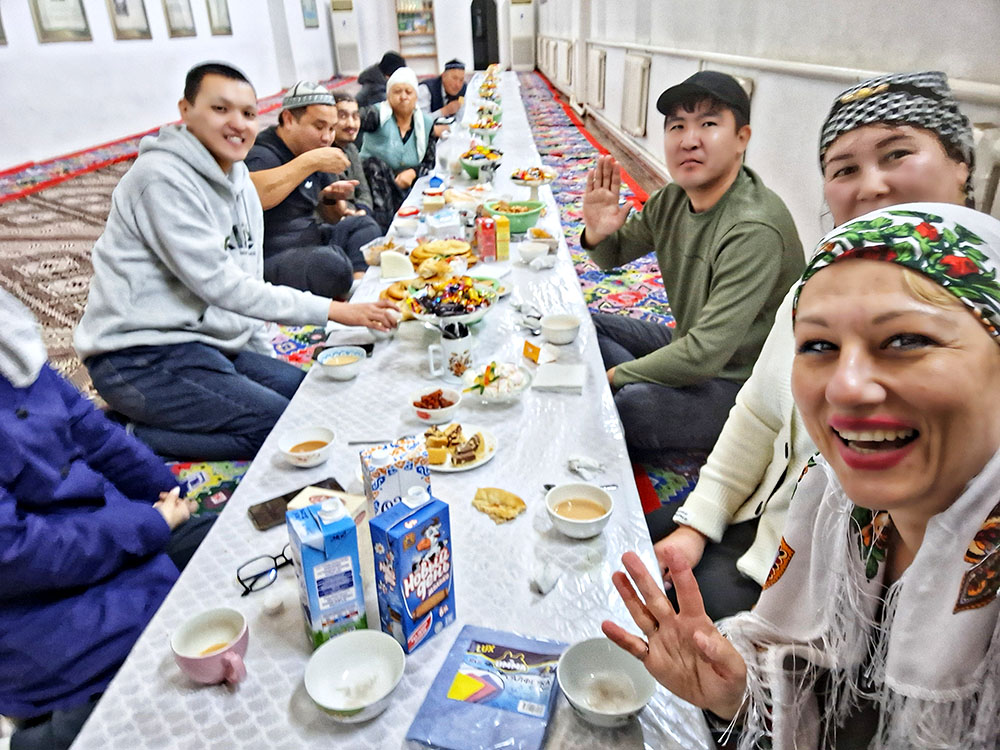
Dinner time with local pilgrims at the Beket Ata guesthouse
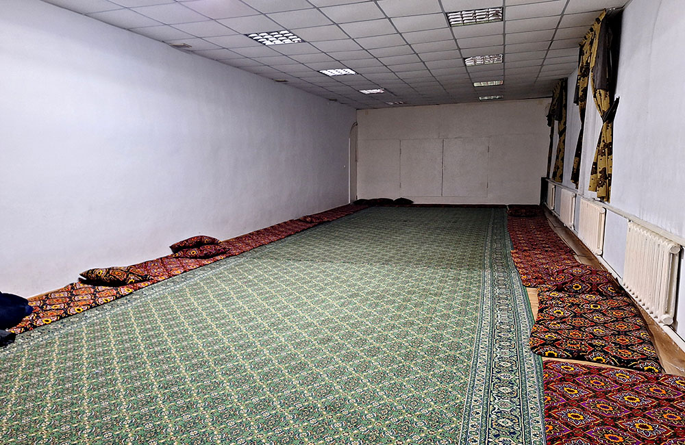
women’s room of the guesthouse
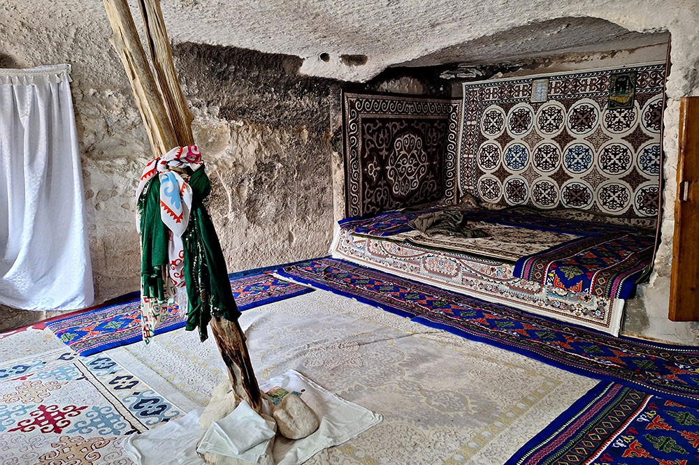
Next morning, my driver Sake suggested that we could visit the underground mosque, which was quite a distance from the main mosque we spent the night, so we started walking down. The view from above was also very impressive, but the temperature had dropped since the last night and the wind was too strong to handle. The underground mosque was 2 km away and since photography was not allowed inside, we didn’t stay for long and came back climbing another 2 km. To be honest, I am not sure if all that hassle was worth it, since the mosque was not that interesting as the previous Shopan Ata, besides the view towards the rocky desert.
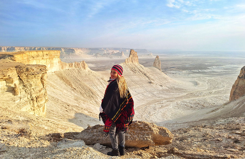
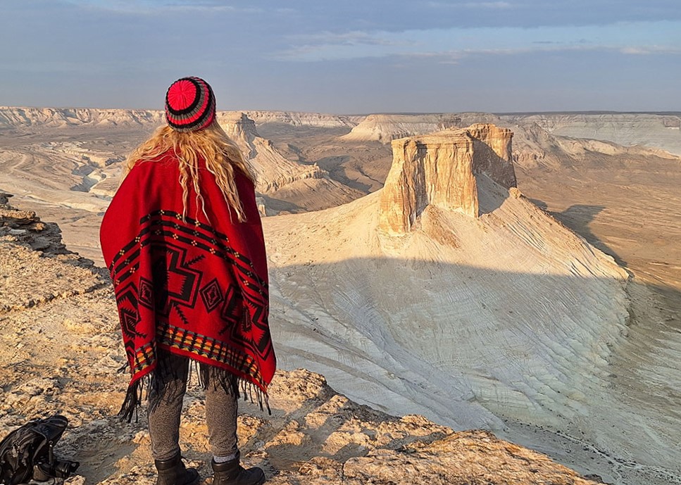
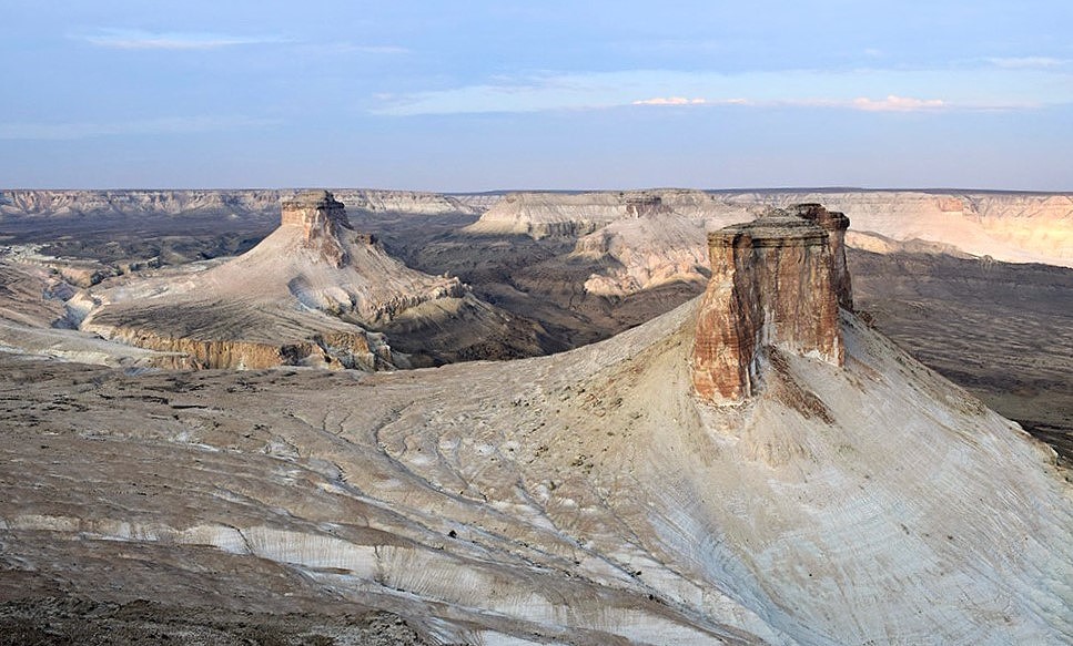
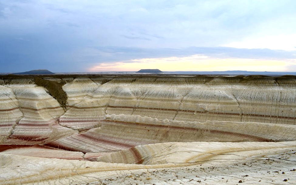
Our next stop was the Bozjyra panorama, which is easily accessible by car and does not require walking or climbing. The view was similar to the previous day, but from the opposite side. Only from that point you can get closer to the smaller rock formations, which are quite a bit further away than the pointed rocks of the previous place. Unfortunately the wind was very strong again, so I couldn’t approach the edge, and generally could not stand still to take photos and videos.
The Ustyurt Plateau is said to have been the bottom of the ancient Tethys Ocean, and there was a constant accumulation of precipitation on it: clay, sand, various organisms. Therefore, it is not surprising that landscapes change their colors at different times of the day. During the daylight in sunny weather, the landscape is snow-white, in the evening it acquires cream shades, at sunset it turns purple.
Going down to the underground mosque
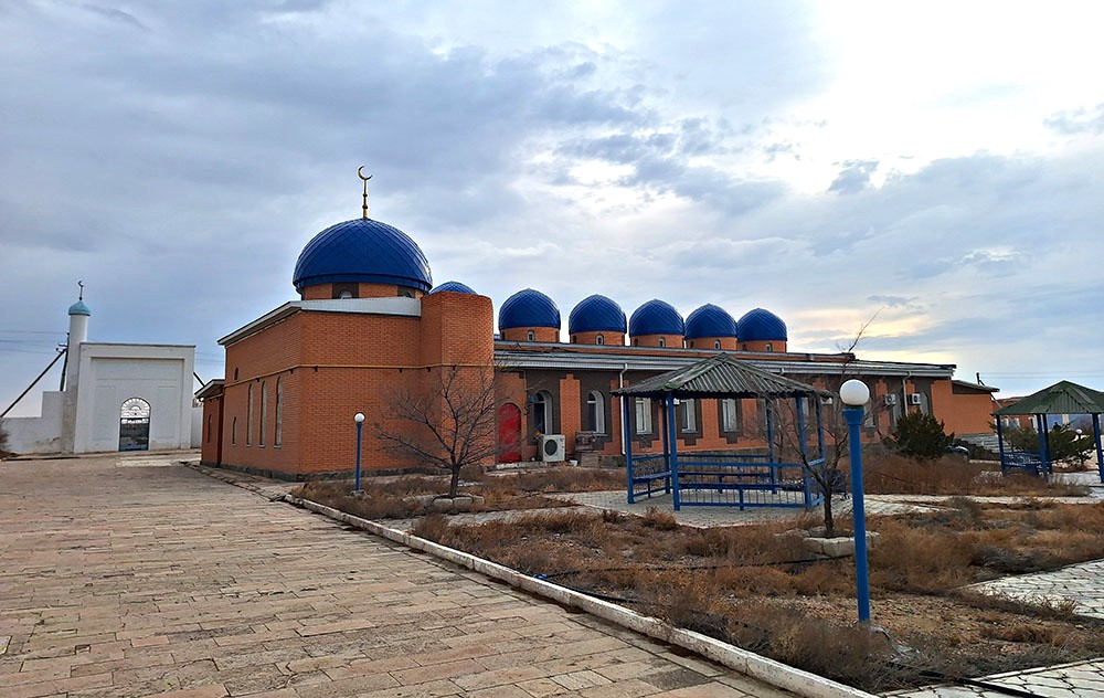
the main mosque
Crossing Bozjyra plateau
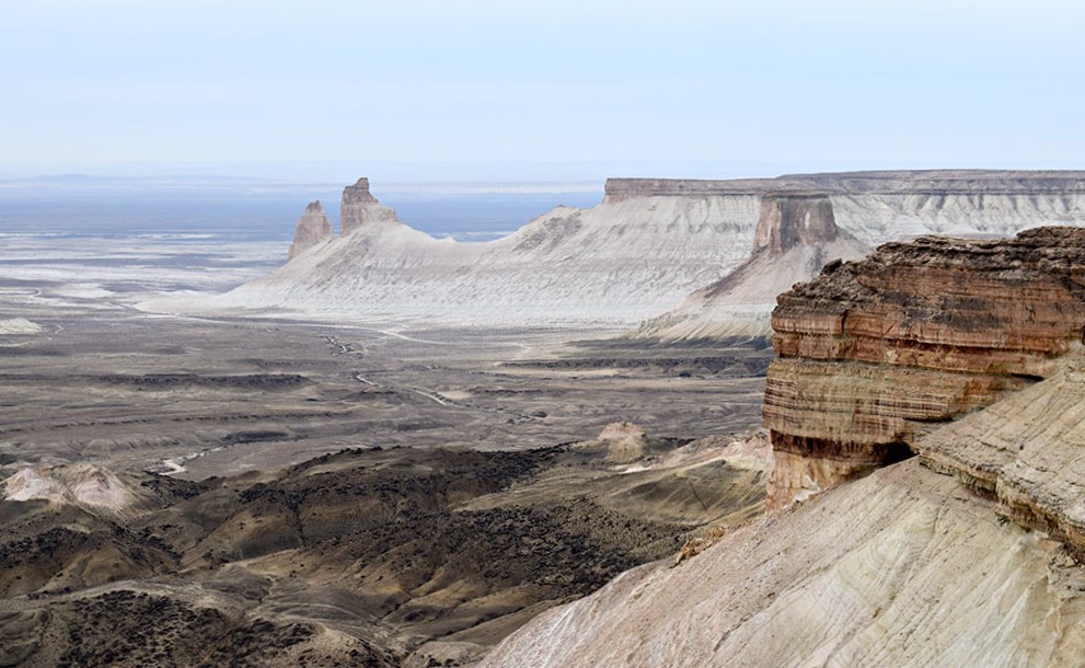
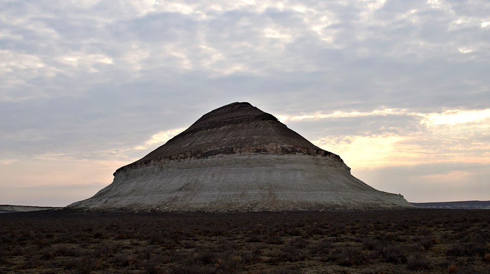
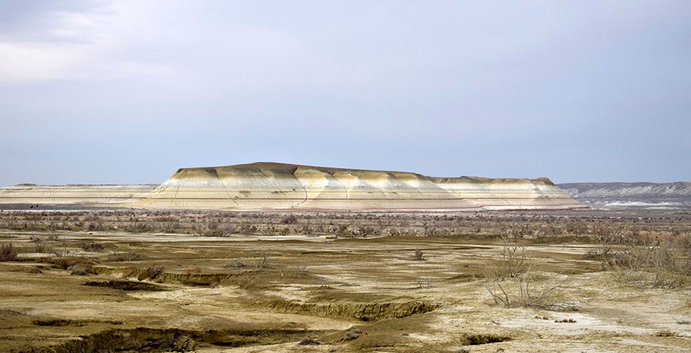
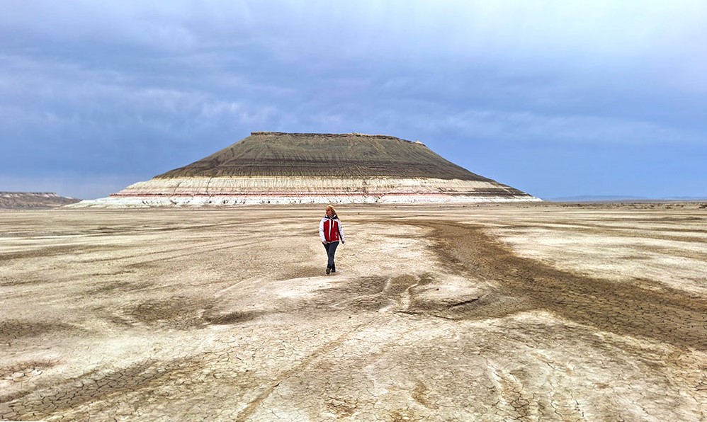
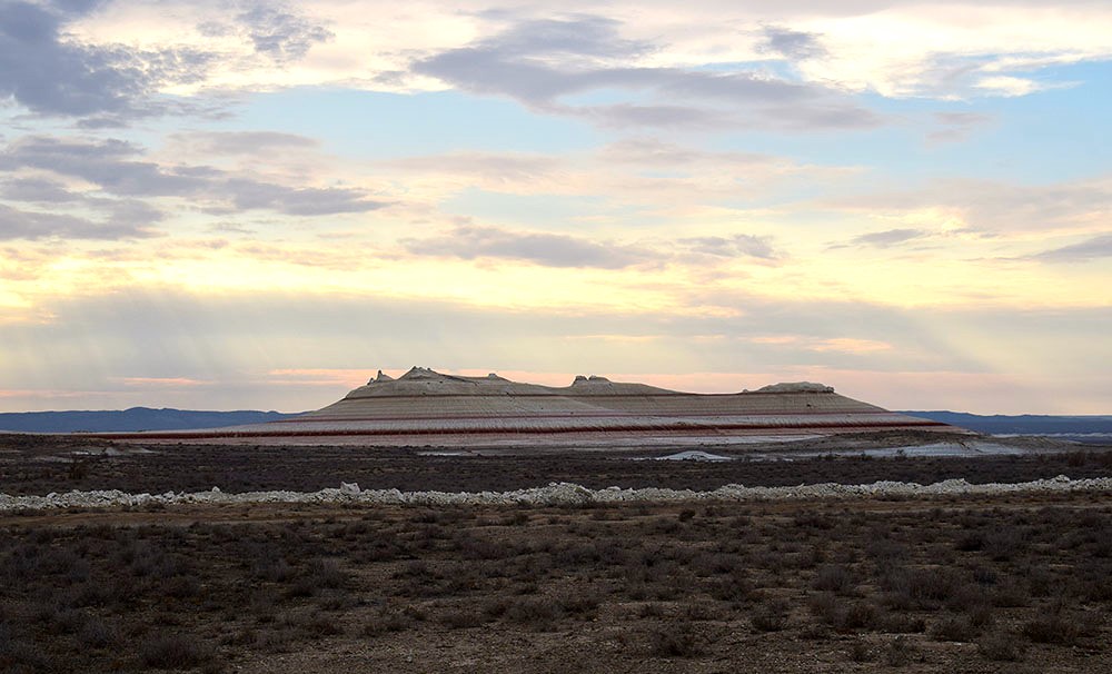
Leaving Bozjyra, we had to drive on dirty roads, actually not real roads, but mostly improvised paths of other previous jeeps. A recent storm had changed the mud terrain, making ditches all around, so we had to change our way too. Finally we made it to the Bokty mountain, the famous figure of the 1000 tenge banknote of the National Bank of Kazakhstan.
“Mount Bokty rises above the flat surface like a huge clay table. On one side, the mountain looks like an overturned white boat with an orange-yellow bottom covered with brown algae. On the other, it is an unusually large pyramid, a creation of nature. The base of mountain in placed at 8 meters above sea level and its height reaches 165 meters. The climate in the region is sharply continental, typical for Mangystau. Precipitation is low, therefore the flora is poorly developed, with few shrubs similar to those of the desert. Regarding animals, camels, scorpions and lizards can be usually seen all around.”
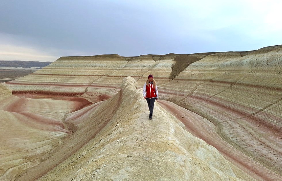
The last stop of our tour was the amazing – A M A Z I N G – Tiramisu Mountain!
I was very impressed by the photos of the mountain, but I didn’t expect that it would be even more spectacular on the spot.
“Kyzylkup (Tiramisu) tract is smooth low hills consisting of rocks of various colors that alternate with each other, creating a fascinating spectacle. The color of the layers is given by impurities of various minerals. The white layers consist of chalk, and the red ones contain iron. Due to its unusual multi-layered structure, the locals often call it “Tiramisu”, just like the Italian dessert. The official name of the tract received from the reservoir, which was once located nearby.”
On the way back to Aktau, we made a short stop at a camel farm, which unfortunately was already closed, and the Mangystau dunes, a very small area of orange sand, reminiscent of the Sahara Desert.
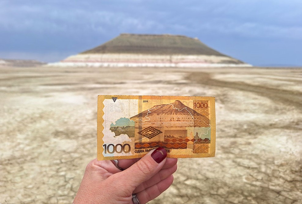
Bokty mountain on the 1000tenge bank note
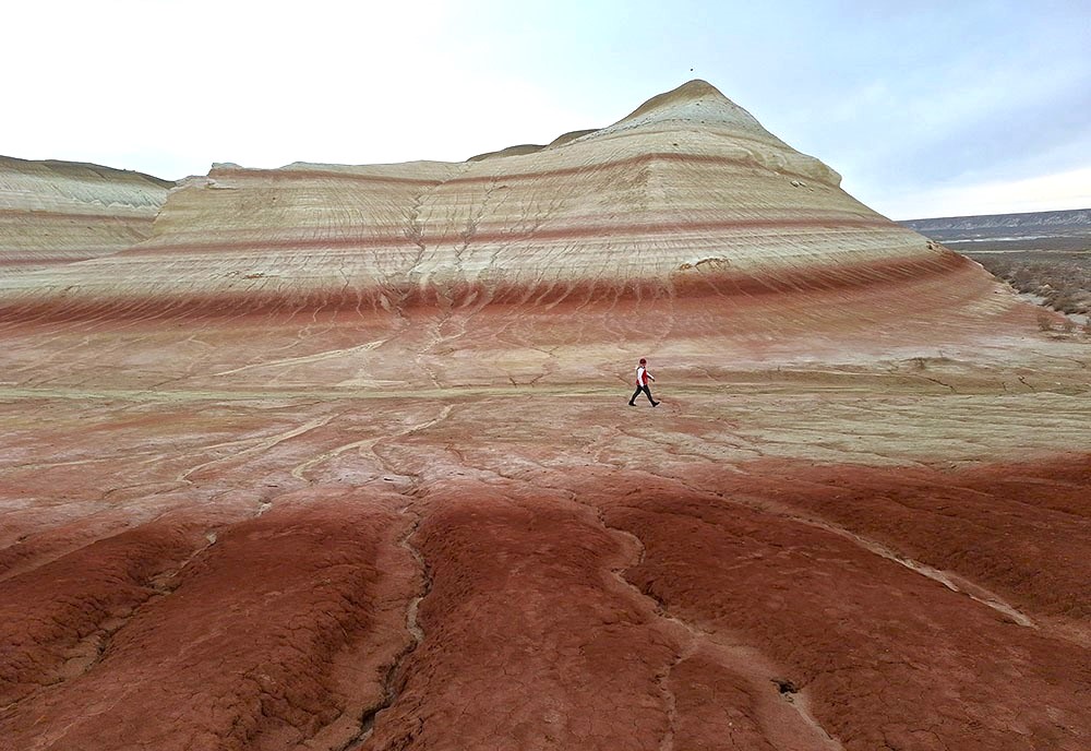
the stunning formations of Tiramisu hills
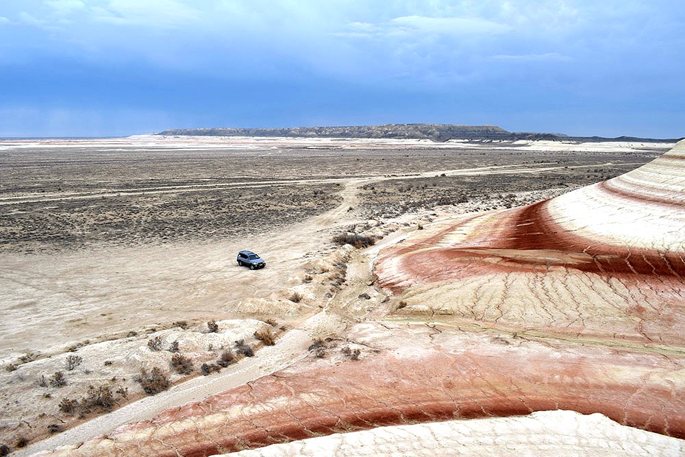
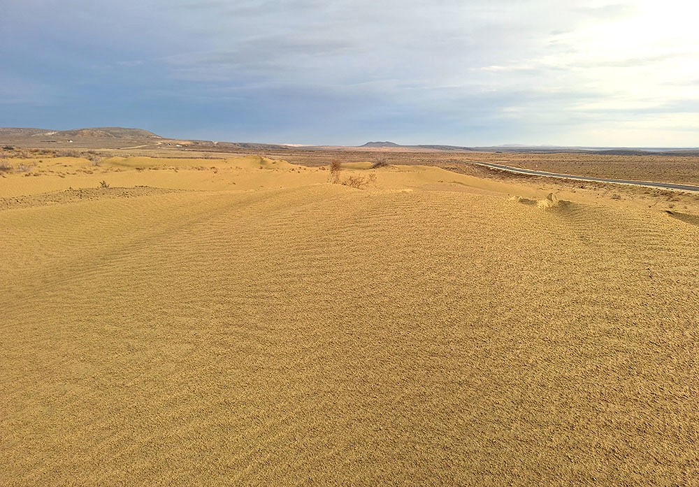
Mangystau sand dunes
My 2-day tour to this stunning region of southwestern Kazakhstan unfortunately came to an end. I returned to Aktau in order to continue my trip around the rest of the country, keeping in my memory all those eerie images of the alien landscape that locals call “planet Mars”.
In any case, whether it is called Mars, the moon, or the bottom of a prehistoric ocean, this unbelievable place of Kazakhstan gives nothing less than chills and awe!
TIPS:
-
Greek passport holders do not need a visa for up to 30 days in the country
-
I traveled by night train, from Uzbekistan to Mangystau a small town 20 km. outside of Aktau, where the nearest train station is located. I used a shared taxi to reach Aktau city center
-
Many flights operate from various countries to Aktau, as it is the main airport of the southwestern Kazakhstan region